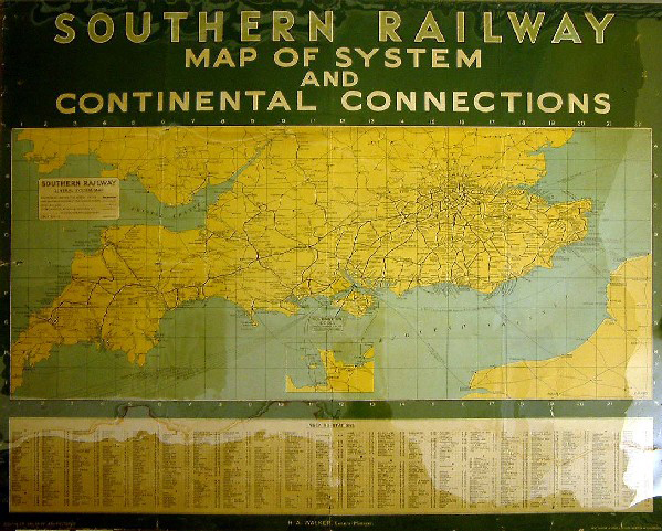
Southern Railway Map of System and Continental Connections
- printer:
- Waterlow and Sons Limited
- publisher:
- Southern Railway
![]() This image is released under a CC BY-NC-SA 4.0 Licence
This image is released under a CC BY-NC-SA 4.0 Licence
Buy this image as a print
BuyLicense this image for commercial use at Science and Society Picture Library
License
Science Museum Group Collection
© The Board of Trustees of the Science Museum
Southern Railway poster. Map of System and Continental Connections, 1932, ref 352 2000/1935. Printed by Waterlow & Sons Ltd., London & Dunstable. With a map of the south of England showing the connections to the continent. Format: quad royal. Dimensions: 40 x 50 inches, 1016 x 1270mm.
Details
- Category:
- Railway Posters, Notices & Handbills
- Object Number:
- 1988-8057
- Materials:
- paper
- Measurements:
-
: 40 x 50 in.; 1016 x 1270 mm
- type:
- poster
- credit:
- Onslow's Auctioneers