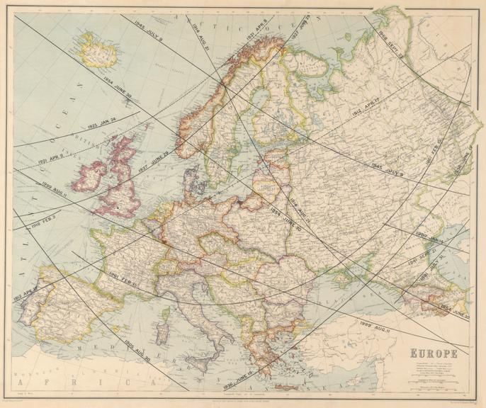
Map of Europe marked with the paths of totality for solar eclipses during the 20th century
![]() This image is released under a CC BY-NC-SA 4.0
Licence
This image is released under a CC BY-NC-SA 4.0
Licence
License this image for commercial use at Science and Society Picture Library
License
Science Museum Group Collection
© The Board of Trustees of the Science Museum
Map of Europe by George Philip & Son Ltd. with lines in ink showing the tracks of all total solar eclipses crossing Europe during the 20th century.
Map of Europe by George Philip & Son Ltd marked with the paths of totality for all total solar eclipses visible in this area during the 20th century. The map was modified by the drawing office of the Science Museum for an exhibition held in 1927. The display at the Science Museum in South Kensington was to celebrate the total solar eclipse that was going to pass over North Wales and North West England that year.
Details
- Category:
- Astronomy
- Object Number:
- 1927-2028
- Measurements:
-
overall: 1.5 x 670 x 560 mm
- type:
- regional maps and solar eclipse
- credit:
- Science Museum (Great Britain)
Related Objects
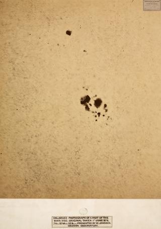
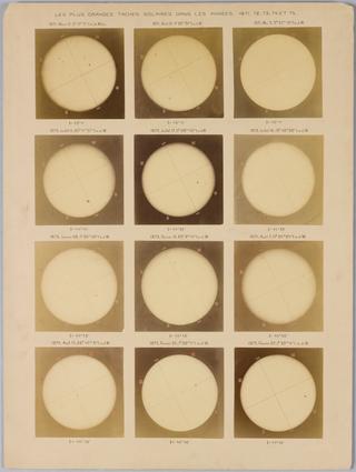
Set of four photographs in window mounts showing an enlarged portions of the Sun's visible disc
Dialytic telescope of 60 mm aperture and 750 mm focal length by S.G. Plössl
Two boxes of Huggins's original photos of Corona