![]() This image is released under a CC BY-NC-SA 4.0 Licence
This image is released under a CC BY-NC-SA 4.0 Licence
Buy this image as a print
BuyLicense this image for commercial use at Science and Society Picture Library
LicenseSMG00031925
Science Museum Group
© The Board of Trustees of the Science Museum
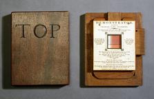
Nautical chart plotter, maker unknown, Italy, 1570-1699.
The square of the plotter is marked with the names of the eight traditional winds of the Mediterranean, as follows:
[TRAM]ONTANA (North – partially obscured in the photos by the arm of the plotter)
GRECO (North-east)
LEVANTE (East)
SIROCCO (South-east)
OSTRO (South)
AFRICO (South-west)
PONENTE (West)
MAESTRO (North-west)
The name of the South-west wind preserves the classical name (AFRICO), in place of the more modern equivalent Libeccio (“Libyan”).
The arm of the plotter is marked with four linear scales for measuring distances on a nautical chart along a chosen bearing. The provision of four different scales allows distances to be measured more conveniently on charts of different scale. There is no interaction in use between the scales marked on the arm and the angles marked on the square.
This instrument is used for plotting and reading bearings on a nautical chart which lacks a compass rose. It was therefore used on plain charts, rather than on Portolan charts, the latter of which are distinguished by their profusion of compass roses and rhumb lines. To use the plotter, the square is aligned with the cardinal points of the compass on the chart. This is why it is square, rather than round, and why it has the names of the winds engraved on it. Then the arm is rotated to the bearing to be plotted or read. The modern equivalent of this device is called a “Hurst plotter”. These days, they are made of a transparent plastic material (such as acrylic) instead. This instrument is essentially unchanged over four centuries, although it has now been rendered obsolete by computerised navigation.
Details
- Category:
- Mathematics
- Object Number:
- 1928-936
- Materials:
- brass (copper, zinc alloy)
- Measurements:
-
overall: 25 mm x 340 mm x 118 mm, 0.218 kg
- type:
- drawing instruments
- credit:
- Thomas H. Court