Southern Railway Heraldic Map
- Made:
- 1933
- artist:
- Charles Shepherd
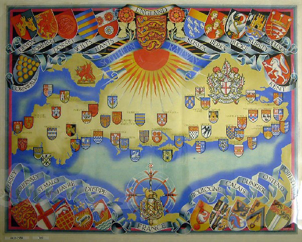
Poster, Southern Railway, heraldic map of towns and counties served by Southern Railway, showing areas of England and France by Shep [Charles Shepherd], 1933. Printed by The Baynard Press, London, format: quad royal, 40 x 50 inches, 1016 x 1270 mm
Details
- Category:
- Railway Posters, Notices & Handbills
- Object Number:
- 2001-7156
- Measurements:
-
overall: 1016 mm x 1270 mm
- type:
- poster
- credit:
- Treacy-Cole, Diane
