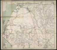

Tuck's Map of the Railways of England & Wales
- Made:
- 1847
Tuck's Map of the Railways of England & Wales, Open for Traffick, in Course of Construction and Projected [and] Railway Compendium. 1847 / Henry Tuck. [Comprises map (70.5 x 57.5cm.), and 'Railway Compendium to Tuck's map ... shewing ... the length and termini of all the railways ... for which acts have been obtained' (73.5 x 42cm.) Part of the John Phillimore Collection: cat. 1, 1847, page 8. Published by E. Wilson, Royal Exchange and Railway Times Office, London]


