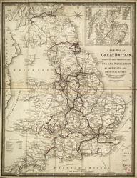
Map, system map, 1839, England, Scotland and Wales, coloured, index, printed by G. Bradshaw, linen-backed paper.
Details
- Category:
- Railway Maps & Plans
- Object Number:
- 2002-8081
- Materials:
- linen (textile) and paper (fibre product)
- Measurements:
-
: 65 x 40 1/2 in.; 1651 x 1028.7 mm
- type:
- map
- credit:
- untraced find