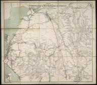

Bradshaw's Map of the Railways in Great Britain, Also the Line of Navigation From the Principal Sea Ports to Both Home and Foreign Station
- Made:
- 1846
- maker:
- George Bradshaw
Map, "Bradshaw's Map of the Railways in Great Britain, Also the Line of Navigation From the Principal Sea Ports to Both Home and Foreign Stations", 1846.
Details
- Category:
- Railway Maps & Plans
- Object Number:
- 2008-7794
- Materials:
- paper
- Measurements:
-
overall: 450 mm x 365 mm
- type:
- map
- credit:
- British Transport Commission


