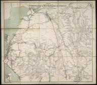

Coloured map. Geological & Mineralogical Map of England and Wales, with parts of Scotland, Ireland & France, showing also the Inland Navigation together with the Rail Roads & Principal Roads, by J A Knipe. 2nd Edition. 1838. Designed and drawn by J A Knipe. Engraved by I Dower, Pentonville, London. Published by J A Knipe, London, 1 June 1838. (Dedicated to the Members of the British Association for the Advancement of Science). Backed on linen and folded with covers and slip case.
Details
- Category:
- Railway Maps & Plans
- Object Number:
- 1996-7918
- Measurements:
-
overall: 16 x 27.5 cm
- credit:
- Powell, C.G.


