Great Western Railway map
- Made:
- circa 1900-circa 1948 in London
![]() This image is released under a CC BY-NC-SA 4.0
Licence
This image is released under a CC BY-NC-SA 4.0
Licence
Buy this image as a print
BuyLicense this image for commercial use at Science and Society Picture Library
License
Science Museum Group Collection
© The Board of Trustees of the Science Museum
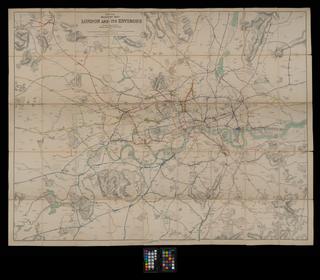
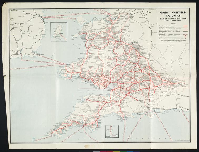
Map of Great Western Railway system and its connections.
The Great Western Railway (GWR) was opened in 1848 and was closely associated with its chief engineer, Isambard Kingdom Brunel. This map created in the early twentieth century depicts how the GWR expanded across the 19th century from its original 118 miles 31 chains long main line from London Paddington to Bristol Temple Meads. Early GWR lines used broad gauge (7 ft ¼ in/ 2,140 mm) track but the company absorbed various standard gauge (4 ft 8 ½ in/1,435 mm) railways and finished converting its remaining broad gauge track to the standard gauge in 1892. The GWR expanded further when the 1921 Railways Act amalgamated the many railway companies into ‘Big Four’ railways, it was the only railway company that preserved its identity.
Details
- Category:
- Railway Maps & Plans
- Object Number:
- 1984-8443
- Materials:
- paper (fibre product) and ink
- Measurements:
-
overall: 491 mm x 630 mm x 1 mm,
- type:
- map
- credit:
- Harris, A. S. G.