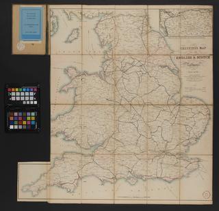
A new map of Great Britain; particularly shewing the Inland Navigation
- Made:
- 1844
- maker:
- James Wyld James Wyld

Engraved map. A new map of Great Britain; particularly shewing the Inland Navigation, by the Canals, and principal rivers, With the Railways, Finished and in Progress, and the principal & secondary stations / James Wyld. 1844. Scale 1" : c. 15m. Cover title is 'Wyld's Railroad Map'. Map originally folded and bound within boards (19 x 12.5cm.)
Details
- Category:
- Railway Maps & Plans
- Object Number:
- 2000-1395
- Materials:
- paper
- Measurements:
-
overall: 750 x 580 mm
folded: 192 mm x 125 mm
- type:
- map
- credit:
- Unknown source


