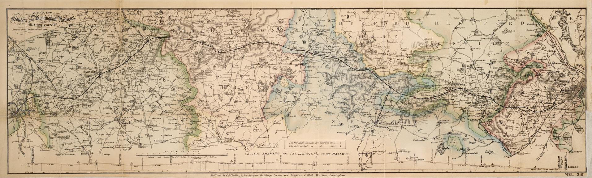
'Map of the London and Birmingham Railway and adjacent country', c 1840
- Made:
- 1835-1845 in London and Birmingham
- publisher:
- Wrightson and Webb and Charles Frederick Cheffins
![]() This image is released under a CC BY-NC-SA 4.0
Licence
This image is released under a CC BY-NC-SA 4.0
Licence
License this image for commercial use at Science and Society Picture Library
License
Science Museum Group
© The Board of Trustees of the Science Museum
Printed and hand coloured map 'Map of the London and Birmingham Railway and adjacent country' Reduced from Cheffins' Official Map / Charles Frederick Cheffins. c 1840. 1 sheet, engraving with wash, scale 1" : 4m. Published by Wrightson & Webb, Birmingham. Originally accompanying handbook to the railway (inv. 1900-206/1) now in Library stock.
Details
- Category:
- Railway Maps & Plans
- Object Number:
- 1900-206/2
- Measurements:
-
overall: 210 mm x 685 mm
- type:
- map
- credit:
- Stretton, C.E. and C.