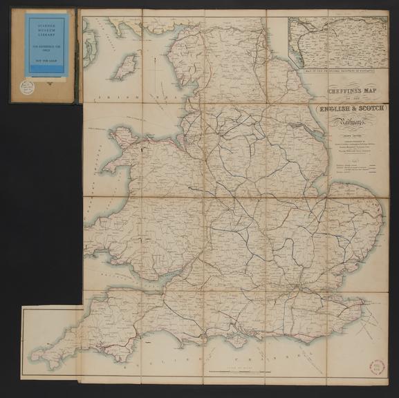
Cheffins's Map of the Railways in England and Scotland
- maker:
- Charles Frederick Cheffins


![]() This image is released under a CC BY-NC-SA 4.0
Licence
This image is released under a CC BY-NC-SA 4.0
Licence
Buy this image as a print
BuyLicense this image for commercial use at Science and Society Picture Library
License![]() This image is released under a CC BY-NC-SA 4.0
Licence
This image is released under a CC BY-NC-SA 4.0
Licence
Buy this image as a print
BuyLicense this image for commercial use at Science and Society Picture Library
License
Science Museum Group Collection
© The Board of Trustees of the Science Museum
Cheffins's Map of the English & Scotch Railways / C. F
Science Museum Group Collection
© The Board of Trustees of the Science Museum
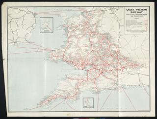
Engraved map. Cheffins's Map of the English & Scotch Railways by C. F. Cheffins, 1845. 4th ed. Scale 1" : c.13 1/2m. Part of the John Phillimore Collection: cat. 1, 1845, page 6. Originally folded and bound within boards (18.5 x 12.5cm.) Cover title is 'Cheffins's Map of the Railways in England & Scotland, Accurately Delineating all the lines at present opened. Also .... the Main Roads throughout the Kingdom with the distances between the Towns ...'.
After the opening in 1830 of the Liverpool and Manchester Railway - the first inter-city line in the world - Britain's railway system exploded into life as engineers, funded by eager investors, wove a system of iron tracks across the land. The excitement and trauma of this new age was everywhere. In 1843 alone more than 200 railway bills passed through parliament. Cheffin's map shows a nation in flux, illustrating both completed and proposed routes.
Details
- Category:
- Railway Maps & Plans
- Object Number:
- 2000-1490
- Materials:
- paper
- Measurements:
-
cover closed, cornwall panel open: 706 mm x 692 mm
flap: 141 mm x 112 mm
- type:
- map
- credit:
- Sotheby and Compan