![]() This image is released under a CC BY-NC-SA 4.0
Licence
This image is released under a CC BY-NC-SA 4.0
Licence
License this image for commercial use at Science and Society Picture Library
License
Science Museum Group
© The Board of Trustees of the Science Museum
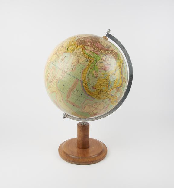
Tectonic globe of the Earth, scale 1:38600000, designed by Kurt Ziesing, redacted by W. Thiele, edited by VEB Hermann Haack, Geographisch-Kartographische Anstalt (Geographical-Cartographic Institute) Gotha / Leipzig, Germany, 1973.
Cartographer Kurt Ziesing designed this globe in the late 1960s as a cartographic experiment, to demonstrate the benefits of mapping geological data in three dimensions. It shows tectonic features using colour and symbols. The data Ziesing used were compiled from Russian atlases, and the globe thus reflects the prevalent theory in Russia at the time that tectonic bodies moved vertically. By the time he was developing this globe, European and American scientists were reaching a consensus that tectonic plates moved horizontally, by continental drift.
Details
- Category:
- Astronomy
- Object Number:
- 2012-34
- Materials:
- paper, nickel plated and wood
- Measurements:
-
overall: 520 mm 330 mm,
- type:
- globe
- credit:
- Dorotheum
Related Objects

SEC vidicon camera tube - identical to one used in IUE (international ultra-violet explorer) satellite

1999 Eclipse tea towel

Lunar photograph taken with the Kew Photoheliograph
Mahogany and brass reflecting quadrant
