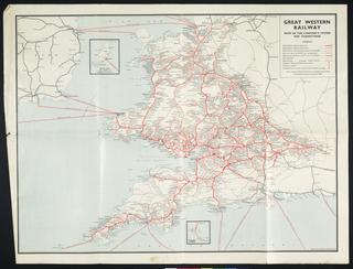
Map of Europe, in relief, showing Southern Railway steamship routes, railway lines and major European lines, horizontal scale 1 inch:26 miles, vertical scale 1 inch:7500 feet, George Philips & Son Ltd., London. Map of Europe, Southern Railway routes
Two maps published by George Philip & Son Ltd and the Central Electricity Generating Board (CEGB). They were used by staff at British Telecoms (BT) and its predecessor organisations. The first map is titled 'Electricity Area Boards', and shows the England and Wales Area Boards pre-April 1957, at a scale of ten miles to one inch. The second map is entitled 'Central Electricity Generating Divisions' and shows these areas in England and Wales, giving the location of power stations, transmission lines etc. The second map is dated April 1958, and is a revision of a map first produced in April 1951. It is drawn at the same scale. Central Electricity Generating Board Maps 1957-1958
Map, 'Yorkshire North Riding', c. 1850, coloured, 1/4 inch to 1 mile, printed/published by George Philips & Son Ltd., paper. Map, 'Yorkshire North Riding' 1850
Coloured map. Philips' Railway Map of the British Isles, with large scale inset maps of the principal industrial centres (Midlands Manufacturing Districts, Newcastle & Middlesbrough Districts, London District, Lancashire & Yorkshire Manufacturing Districts and Edinburgh & Glasgow District). (c1916). Published by George Philip & Son Ltd. Backed on linen. 785 x 1012mm. Philips' railway map of the British Isles 1916
Guidebook, London & North Eastern Railway, "The Silver Jubilee. Britain's Original Streamline Train", winter 1938-39, map with plan of train and timetable, 6 pages, soft cover - pamphlet. LNER: The Silver Jubilee; Britains Original Streamline Train 1938-1939
"Philips' Railway Map of the British Isles showing the new Grouping System" 1923. With insets of the principal industrial centres. Philips' Railway Map of the British Isles showing the new Grouping System 1923
Route map. Map of UK & London & North Eastern Railway routes. London & North Eastern Railway. Format: double royal. Dimensions: 40 x 25 inches, 1016 x 635mm. route map; 1939