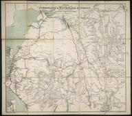

Coloured map. London & North Eastern Railway. Map of the LNER and Connections showing Principal Stations. (c1924/1925). (With, on reverse, details of how to get to the British Empire Exhibition at Wembley by LNER services). Printed by W & AK Johnston Ltd, Edinburgh & London. Folded with covers. 395 x 696 mm (flat). 114 x 178 mm (folded).
Details
- Category:
- Railway Maps & Plans
- Object Number:
- 1997-7143
- Measurements:
-
: 395 x 696 mm
- type:
- coloured map
- credit:
- Conrad, Philip J.


