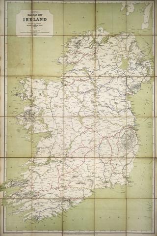
Map of Ireland
- Made:
- circa 1845 in Dublin
- maker:
- Irish Railway Gazette and W H Holbrooke
Map, paper, Map of Ireland Shewing all the lines of Railway Completed or in Progress, especially laid down by their respective Engineers, issued by the Irish Railway Gazette, engraved by W.H. Holbrooke of 2 Crow Street, Dublin, circa 1845.
Details
- Category:
- Railway Maps & Plans
- Collection:
- Chester Archaeological Society
- Object Number:
- 2015-7186
- Materials:
- paper (fibre product)
- Measurements:
-
overall: 479 mm x 389 mm
- type:
- map
- credit:
- Chester Archaeological Society