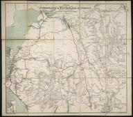

Map of the Coal Field, of Northumberland & Durham, shewing the ascertained Collieries, Pits, Faults, Dykes & other Interruptions with the railways & ports of shipment constructed for the coal trade [5 sheets]
- Made:
- 1851 in Newcastle upon Tyne
Map of the Coal Field, of Northumberland & Durham, shewing the ascertained Collieries, Pits, Faults, Dykes & other Interruptions: with the railways & ports of shipment constructed for the coal trade / William Oliver et al. 1851 [5 sheets, lithos with colour, scale 1 1/4" : 1m. Published by M. & M. W. Lambert, Newcastle-upon-Tyne]
Details
- Category:
- Railway Maps & Plans
- Object Number:
- 1998-83
- Measurements:
-
overall (each): 760 cm x 645 cm
- type:
- map
- credit:
- Unknown source


